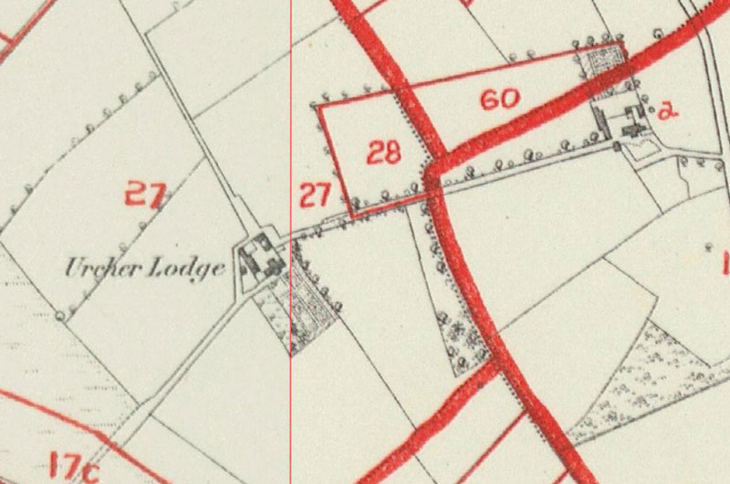
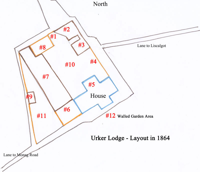
In order to orient these photos, I am repeating two of
the maps that I have also been posted in my 2nd Blog post:
Photos of the buildings and grounds taken in 2003 and 2010 by myself, and Ian Jackson.
 |
The view of the South facing side of Urker Lodge as it appears from the main road beneath. |
|
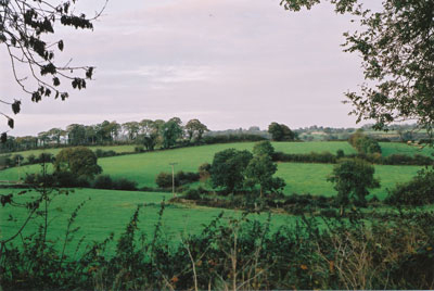
Looking over the fields: View from Urker |
|
The lane leading to Liscalgot.
|
|
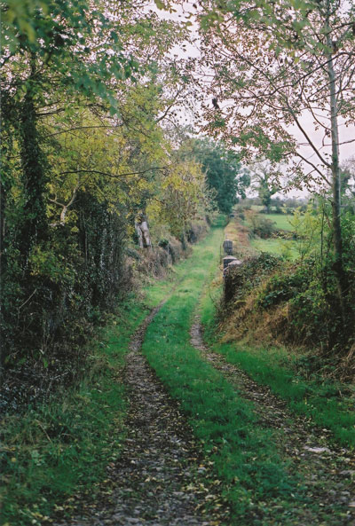
The lane leading from Monag Road. Note the trees are on
the north-westerly side of the lane on the lower part of the lane.
|
|
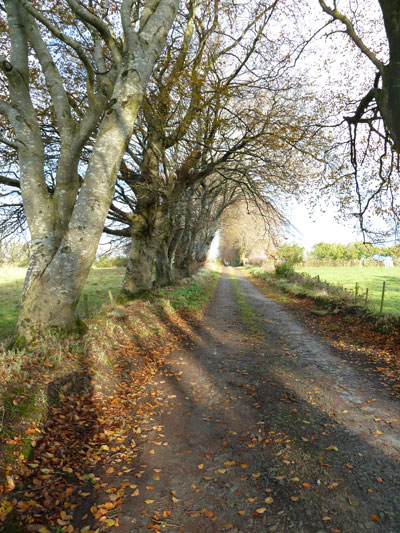
Halfway up the lane. NOTE the trees are on the south-easterly side of the upper part of the lane. I doubt that these trees were planted by Archbishop Boulter
as part of the improvements to the Charter Lands in 1738. They do not show on
the survey map of 1864, whereas the trees leading to Liscalgot leading from the
northerly side of Urker Lodge are indicated, and may date back
that far. |
|
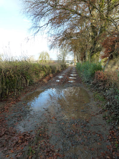
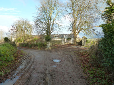
Approaching Urker from the lane leading from Monag
Road. The gates leading to the South west corner of the compound lie ahead. |
|
The gates leading to the South west corner of the
compound (L-R #7 & #6 on the map). |
|
Steps leading to the North East side of the house. |
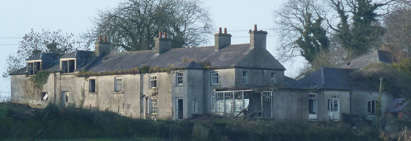
Here is what the ruins of the buildings look like from
photos taken from 2003-2010, as well as a few my ruminations about what we can learn from
them:
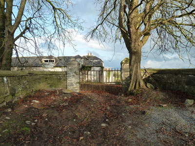
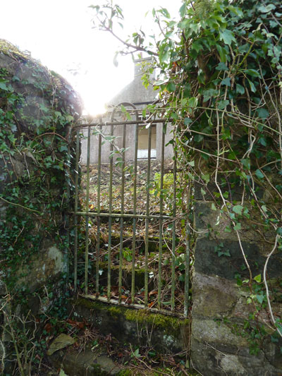
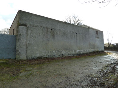
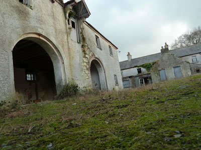
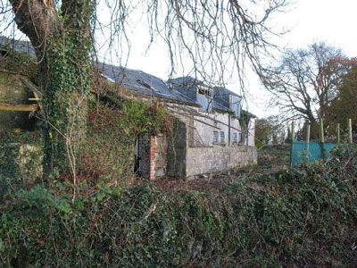
#7 & #8 & #1 & #2 The North wall of the
compound. Currently, the entrance has a metal gate. It would have been a
wooden one in the mid-1800s. |
|
On the western side of the north wall
(to the left in this photo)are the stables. |
|
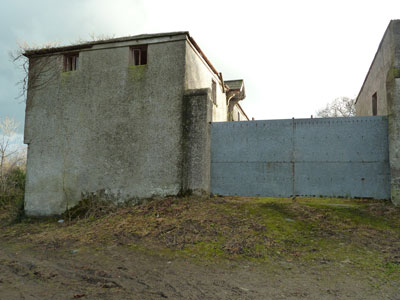
On the most easterly side (to the right in this photo),
the section with the peaked roof on the extreme right hand side is where a building was
indicated in 1864. The part between it and the current gate, was outlined, but
was not a building. This would indicate that this section with the roof sloping into the quadrangle was built
later. |
|
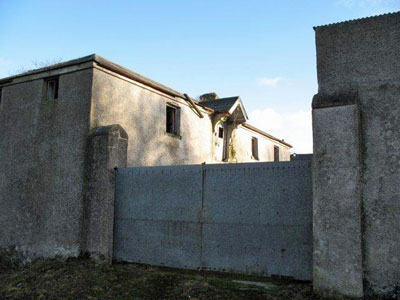
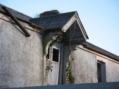
This photo taken by Ian Jackson in 2010 shows the width
of the gate, and the two pillars either side. The two pillars may be a help
in placing other photos taken pre-1900. |
#10 Views looking from the interior of the courtyard |
|
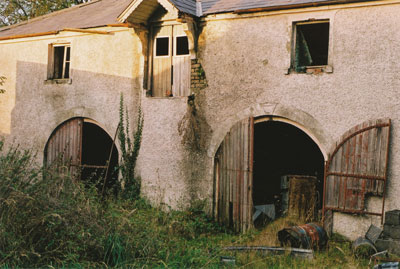
A view of the stables in 2003. The building was built
of brick, covered with a coat of cement. NOTE: The brick masonry is visible to the left of the doors beneath the peaked overhang. |
|
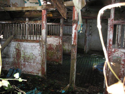
The interior of the stables. Note the cobblestone
flooring. |
|
Shot from under the metal gate, facing the stables and
the side of the house that faced the courtyard. |
|
A view from the interior courtyard looking east towards
the stables #2 & #3. Photo credit: Ian Jackson. |
 |
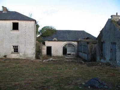
#10 A view from the interior courtyard looking southwards
towards the house. Note the brick construction of the gabled section that
tees from the main house into the courtyard. Photo credit Ian Jackson. |
|
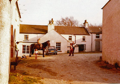
How it looked this same view of the house appeared in the early 1970s. Photo credit: Christine Wright. |
#11 The view looking towards the exterior west wall |
|
The view looking towards the exterior west wall The boards sticking out mid-way
are where greenhouse was shown to be in photos from 1890. The boards that remain are the ones that were installed when Christine rebuilt the greenhouse. By that time, the old greenhouse was long gone.
Photo credit: Ian Jackson.
|
#8 & #1 & #2 viewed from the interior courtyard
facing north-west |
|
The house is on the right. The structure with the archway was turned into a playroom for children. Photo credit: Ian Jackson. |
 |
The interiour of this building. Note that the walls were made of stone. The archway indicates that it was once used as a stable, or else a cart house/coach house - the equivalent of a 19th Century garage. |
Interior views |
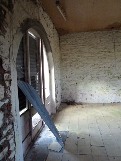
|
An archway was made when the wall was opened up for
a kitchen to be added on to the east wall of the original house. The
fireplace to the right of the archway ties into the original chimney. Photo credit: Ian Jackson |
|
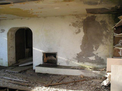
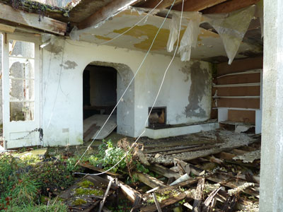
Another perspective, taken by myself, in 2010. After the 1970's additions, the room in the foreground was used as a drawing room, and the room on the other side (not visible) was used as a dining room. |
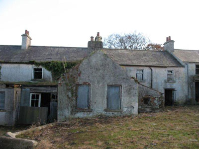
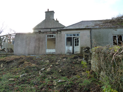
View of North eastern exterior #5 & #4 |
|
On the left was a shed that Christine converted to a
pantry, and on the right a shed that was converted to a playroom for the children.
In the 1864 map, the structure on the left did not exist. |
|
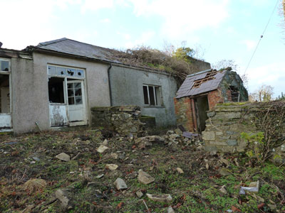
This view is looking slightly further to the north that
the previous shot. Note the wall in the foreground at right angles to the building. It is likely older than the
buildings. Also note the concrete box just inside the wall on the left. |
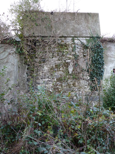
This is most either a north-westerly portion of the building I have labled: #7, or else part of #8 |
|
Note the stone walls of this structure. I couldn't remember quite where it was, but since I first posted this page, Christine and I have chatted. It was further along past the red outbuiling in the picture above (which she thinks was probably the outhouse). |